Newsletter

The Bellanda Tower

The Bellanda Tower. Source : http://www.nicetourisme.com

Located in the commune of Nice, the Bellanda Tower guards over the Baie des Anges, in the south of the castle grounds.

Located in the commune of Nice, the Bellanda Tower guards over the Baie des Anges, in the south of the castle grounds.

A medieval defensive structure built on the site of an ancient acropolis, in 1825 it was converted into a belvedere. Berlioz is said to have composed his “King Lear” overture there in 1831.

Until 2006, the tower housed the naval museum, which is currently closed.

Bellanda Tower gallery

Colline du Château

Tél: 33 (0) 497 13 23 95

Open 10 am to 6 pm, except Sundays and some bank holidays. Free admission.


Nice Tourist Office


Quiz: Forts and citadels

> Return to results

Practical information

Address

Place du 8 mai 1945 parc du château 06300
Nice
04 97 13 23 95

Weekly opening hours

Du 1er avril au 31 mai et du 1er au 30 septembre:de 8h à 19h. Du 1er juin au 31 aout: de 8h à 20h. Du 1er octobre au 31 mars: de 8h à 18h

Faubourg d'Amiens Military Cemetery - Arras

Flying Services Memorial. Source: Jean-Pierre Le Padellec SGA/DMPA


This cemetery shelters 2,651 graves and displays the names, inscribed on the perimeter wall, of the 35,942 men who were never recovered following the Battles of Arras.


Arras and the First World War (1914-18)

Arras was at the centre of battle throughout the First World War. After falling into German hands in 1914 and then taken back by the French, it was defended by the British Expeditionary Force (BEF) from spring 1916. Almost razed to the ground, the town had become an underground city organised into a maze of galleries several kilometres long (known as boves) that were used during the great offensive of 1917. At the start of April, at dawn, some 20,000 British soldiers emerged in the surrounding German trenches to the complete surprise of the enemy, managing to seize officers as they were having breakfast.


For the Commonwealth forces, this was an absolute massacre: 159,000 men lost in 39 days, or the equivalent of 4,076 deaths every day. While notching up the biggest death toll, this offensive was nevertheless a significant military victory, perhaps the only one achieved by the Allies in 1917. In 1918, the Germans attempted, in vein, to recapture Arras.


Within the walls of the cemetery, all men are equal. The memorials were created in this spirit, with soldiers and officers lying side by side. The Cross of Sacrifice symbolises the faith of the majority (Christian) whole the Steele Memorial was built in honour of the men of other faiths and atheists.

Used from March 1916 by the British forces, the cemetery was enlarged after the Armistice by the graves repatriated from the battlefield and two small cemeteries nearby. It is the site of 2,651 burial places of Commonwealth soldiers who fought in World War I. A further 30 graves hold men of other nationalities, mainly German. Seven graves date back to the Second World War, when Arras served as the headquarters of British troops until the town was evacuated on 23 May 1940. In German hands at the time, it was taken back by the Allies on 1 September 1944.


For those with no known grave

The cemetery features a memorial that pays tribute to the more than 35,000 missing soldiers whose bodies were never found. These men fought in terrible conditions, against the deadliest weapons of war the world had ever known. Sent from the United Kingdom, South Africa and New Zealand, they fell in the Arras region between spring 1916 and 7 August 1918, the eve of the March to Victory. The Canadian and Australian soldiers killed during this period are commemorated by the memorials in Vimy and Villers-Bretonneux. A specific memorial honours the men who fell during the Battle of Cambrai in 1917.


The Flying Services Memorial bears the names of around 1,000 men from the Royal Naval Air Service, the Royal Flying Corps and the Royal Air Force (following the merger of the RNAS and the RFC in April 1918) who were shot down on the Western Front and have no known graves. For the pilots involved in the Battle of Arras, April 1917 was dubbed Bloody April and life expectancy fell to three weeks at 5.30 p.m. Fiercely efficient, the German airforce decimated the RFC forces by a third in just one month.


Faubourg d'Amiens Military Cemetery

Boulevard du général de Gaulle 62000, Arras


Office de tourisme d'Arras


> Return to results

Practical information

Address

Boulevard du général de Gaulle 62100
Arras

Prices

Free admission

Weekly opening hours

Open all year

Cantigny

Plaque – Detail of the Monument to the US 1st Division. Source: www.usmilitariaforum.com

The Battle of Cantigny in May 1918 was the first major American battle in the Great War.

The Battle of Cantigny, which took place from 28 to 31 May 1918, remains extremely important in the history of the United States as it was the first major American battle in the Great War.

The Battle of Cantigny helped to contain the German offensives during the spring of 1918, giving newfound confidence and morale to the Allies and demonstrating the American soldiers’ fighting skills. General John J. Pershing wrote, "It was a question of pride for the American Expeditionary Forces that the division’s troops, in their first battle... should display the moral strength and courage of the veterans, holding on to land taken and refusing to let the enemy take the slightest advantage".

Over 1,000 American soldiers were put out of combat during this battle and 199 of them died. At Cantigny, the 1st Division began a series of American successes, powerfully amplified by the heroic position of the 2nd and 3rd US Divisions along the Marne a few days later. With nearly one million Americans in France at the time, the Allies’ morale was about to change, from a defeatist spirit to the certainty of victory soon to come. Cantigny was the first battle of the US 1st Division (now known as the 1st Infantry Division) which was again to make a name for itself in 1944 during the attack on Omaha Beach in Normandy on 6 June.

Many famous Americans fought at Cantigny, including George C. Marshall, Army Chief of Staff during World War II and later Secretary of Defence and the Secretary of State who implemented the Marshall Plan. Robert R. McCormick, owner of the Chicago Tribune who changed the name of his property to Cantigny when he returned to the United States. Upon his death, the property was transformed into a park open to the public in keeping with his last wishes; a foundation that bears his name was set up along with a museum dedicated to the history of the 1st Division from 1917 to the present, in Wheaton, Illinois. There are several monuments in Cantigny, in the Somme department, that serve to remind us of their exploits. A small private museum houses vestiges of the battle and can be visited by appointment.

"Pays de Parmentier" Tourist Office
5 Place du Général de Gaulle 80500 Montdidier
Tel.: +33 (0) 322 789 200 Fax : +33 (0) 322 780 088
Mail: ot-montdidier@orange.fr


Somme Somme Tourism Committee

“Pays Parmentier” Tourism

 First Division Museum

La Somme 14-18

> Return to results

Practical information

Address

5 Place du Général de Gaulle 80500
Montdidier
Tél : +33 (0) 322 789 200Fax : +33 (0) 322 780 088

Weekly opening hours

Accessible year round

The Memorial of Camarón in Mexico

Célébration de la bataille de Camerone le 30 avril 2010. ©2rei.legion-etrangère.com


The Memorial of Camarón in Mexico commemorates the battle of 30 April 1863 during the Mexican Expedition of 1861-67 by the 3rd Company of the Foreign Regiment under the command of Captain Danjou.


The monument pays tribute to “military valour”.

It stands in the spot where on 30 April 1863 a battle took place in which 3rd Company of the Foreign Regiment won fame during the French intervention in Mexico under the Second Empire.

65 legionnaires, taking refuge on a farm in Camarón, stood up to 2,000 Mexican guerrillas. In 1906, the anniversary of this battle was named the Festival of the Foreign Legion.


The present building was constructed between 1962 and 1965. Captain Danjou and his men were first buried in a communal grave on 1 May 1863.

In 1892, the French Consul in Veracruz organised the making of a single grave. Finally on 6 April 1963, the ashes of the legionnaires were transferred to the current site. It is situated in the town of Camarón de Tejeda, formerly Camarón, in the State of Veracruz, 60 km from its eponymous capital. The building was erected 500 metres from village, along the road that leads to the municipal cemetery. It stands in 10 acres of grounds. The memorial itself is made of a concrete platform covering 2.5 acres that houses the collective grave of the legionnaires of the 3rd Company of the Foreign Regiment.

The site has been the private property of the "Camarón “association (Camarón Civil Association) since 1966; they are responsible for managing and maintaining the site with the financial support of the Department of Remembrance, Heritage and Archives.

Each year, a commemorative ceremony brings together the Camarón council, the Mexican authorities (Veracruz’ government), detachments from the army and the navy as well as neighbouring school communities and a number of delegations.


Camarón Association

Presa Azucar no. 42 Col. Irrigación 11500 Mexico, D.F.

Tel: 55 52 22 08

> Return to results

Practical information

Address


Camarón de Tejeda (94230) - Mexico
Tél. : 55 52 22 08

Prices

Free admission

Weekly opening hours

Open all year

Fort de Bron

The caponier. Source: Association of the Fort de Bron

This fort was responsible for preventing any enemy from crossing the heights of Chassieu or St-Priest and advancing towards Lyon.

It was responsible , thanks to the weaponry it contained (155 mm and 120 mm artillery pieces - 220 mm mortars) for preventing any enemy from crossing the heights of Chassieu or St-Priest and advancing towards Lyon, or setting up their own canons, which would then have been able to bomb the town. Trapezoid in shape, which is a characteristic of polygonal fortifications, the length of its perimeter was protected by a dry moat, which prevented the central structure from being surrounded by an infantry attack. Its buildings were covered with a mass of earth in order to absorb the effects of projectiles (an anti-impact layer). In the event of war, its garrison was increased to 841 artillery and infantrymen. More than 1500 m² of stores of various kinds housed provisions and munitions, food supplies, fuel and equipment etc.

History: Advances in artillery quite rapidly rendered this type of fortification obsolete and unsuitable. Nevertheless, the deterrent factor of any fortress could never be totally removed. It remained partly armed up until 1914. After 1920, it had only a logistical role for the nearby air base. It would be occupied by German troops in 1942, and finally given to the urban community of Lyon (la communauté urbaine de Lyon or COURLY) in 1975, to be used as a support building for the enormous water reservoirs. The town of Bron uses it for storing council equipment, for which the COURLY has granted a long lease in return for a modest rent.
The Association of the fort de Bron, created in 1982, brings together all the people and associations who want to contribute to the development, improvement and running of the place. Its administrative committee, with two permanent elected officers from the BRON district, defines the work that needs to be done and participates in the research work on future projects carried out by the council. A sports track and circular walk have been created. A long-term programme is planned for the renovation and conservation of the Fort: access to most of the moats, making some of the rooms in the Fort available for public use and the temporary opening of part of the interior for cultural, community and theatrical events.
The association is particularly keen to promote the historical heritage of this example of military architecture from the end of the 19th century. On the first Sunday of every month it organises free guided tours of the Fort and its museum, from 1.30 to 4.30 pm in winter and 2 to 5 pm in summer. It also organises occasional tours for associations and schools (requests to be addressed to the cultural department of the mairie).
It takes part in Heritage days and holds an artwork exhibition on the first Saturday and Sunday in October. The Fort de Bron belongs to the fortified defence system set up around Lyon after the war of 1870, at the instigation of General Séré de Rivières, who was responsible for fortifications on a national level. One room in the Fort bears his name. A museum is in the process of being established, with new documents and photographs from the period, as well as a visual display showing the different parts of the fort.
Fort de Bron Avenue Maréchal de Tassigny 69500 Bron Association du fort de Bron Bt 74 Maison des sociétés square Grimma 69500 Bron Tel: + 33 (0)6 60 65 25 23 E-mail: chaandre@numericable.fr

> Return to results

Practical information

Address

Avenue Maréchal de Tassigny 69500
Bron
Tél. : 06 60 65 25 23

Weekly opening hours

tous les premiers dimanches de chaque mois en période d'hiver de 13h30 à 16h30 et en période d'été de 14h à 17h, en après midi.

Fort Saint-Louis in Fort-de-France

Le fort Saint-Louis à Fort-de-France. ©Michel FRANCES - Source : blog.kermorvan.fr

 
Fort Saint-Louis, built in the 17th century, is situated in what is now Baie du Lamentin in Martinique.


Originally located in Saint-Pierre, Jacques Dyel du Parquet, lieutenant general of Martinique since 2nd December 1637, became aware of the nautical and strategic advantages of the "Royal Cul de Sac", the current Baie du Lamentin.
 
He decided to have a retrenchment built on the extreme south of a spur that closed the bay, with a few planks of wood as a stockade. He posted a garrison of 200 men armed with canons. This camp became "Fort-Royal" in 1664 when the king purchased the rights from du Parquet's successors.

After an English wing destroyed French ships moored in Saint-Pierre in 1667, it was decided to instead use the "Royal Cul du Sac" site and to reinforce the "Fort-Royal" by replacing the stockades with masonry structures, extending the hold to the entire peninsular.


The efficacy of the system was proven in 1673 when a Holland wing, which came to attack moored French ships, was forced back by the fort's canons.
 
From 1674 to 1703, a number of reinforcements were made under the impetus of the governors of Baas, Blénac and Amblimont, with assistance from the engineer, Payen.
 
On 14th September 1681, the royal pennant which had flown until then over Saint-Pierre was transferred to Fort-Royal. At the same time, the city of the same name was built.
 

Le fort Saint Louis est ouvert à la visite tous les jours. Ce monument historique, dont le ministère de la défense est affectataire, fait partie d'un protocole Culture Défense, signé le 17 septembre 2005.


Bureau des actions culturelles et muséographiques e-mail : dmpa-sdace-bacm@sga.defense.gouv.fr


Ministère de la culture


Quizz : Forts et citadelles


> Return to results

Practical information

Address

972
Fort-de-France

Weekly opening hours

Ouvert à la visite tous les jours.

Fort de Villiers

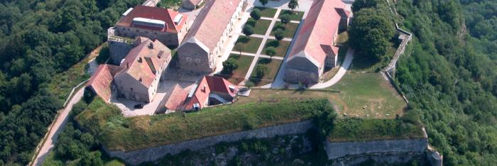
Postcard of the fort Source: Association de Sauvegarde du Fort de Villiers

Fort de Villiers is a witness of the fortifications of Paris and the history of the Third Republic.

"Bridgehead on the Marne" (Noisy-le-Grand - 93) 


1871.

The first ring of forts built with the purpose of protecting the capital from the enemy did not prevent the defeat of 1870.

 
In the space of a few weeks, Bismarck's troops had surged into Paris, the Empire's armies had surrendered, Napoleon III had been taken prisoner, and the armistice, signed in January 1871, led to Alsace-Lorraine being annexed to the German Empire. 
 
On 21st March 1874, the project of the army commission was adopted at the National Assembly, by 386 votes to 191.
 
The bill of 27th March 1874 concerning the building of new forts around Paris authorised the Prime Minister, Adolphe Thiers, to erect a fortified "ring" around Paris as part of a comprehensive fortification project, implementation of which was entrusted to General Séré de Rivières, at the time Director of Engineering:
 
"For this we will need to occupy, probably between Noisy-le-Grand and Villiers, a position creating a bridgehead and at the same time covering the waterways of the bridges at Brie, Nogent, Joinville and Champigny.
 
The fort constructed at this point will be the most effective way of protecting the perimeters of the Fort de Nogent, and will be connected to the Chelles-Vaujours line." 60,000,000 old francs (one Germinal Franc = 1.42 euros in 2007) were allocated to the works and purchase of land.
Between 1874 and 1881, 18 forts, 34 defensive batteries and 5 redoubts were built around Paris The eastern part of this defence system was made up of the Fort de Villiers, which today falls within the town of Noisy-le-Grand (1878-1880), the Fort de Champigny (1878-1880) and the Fort de Sucy (1879-1881).
 
An implementation order of 31st December 1877 set out the provisions for the construction of Fort de Villiers in the town of Noisy-le-Grand (at the time in the Seine et Oise département), originally named the "Bridgehead on the Marne".
 
Constructed on the heights above the banks of the Marne at an altitude of 111 metres, the fort was intended to prevent the enemy from establishing itself there. The works commenced in 1878 and were finished in 1880.
 
The plan marking the boundary, the access zone and the remarkable polygon was approved by the Minister for War on 18th October 1882 and officially recognised and approved by decree on 10th September 1883. 
 
 
The budget for the construction of Fort de Villiers had been estimated at 11,000,000 francs for the work and 1,000,000 francs for the purchase of land. 
 
 
The Fort de Villiers today
 
Property of the Ministry of Defence and afterwards of the public EPAMARNE institution, in July 2001 the latter donated it to the town of Noisy-le-Grand.
 
The area created within the current perimeter of the Fort de Villiers covers approximately four hectares - originally seven hectares - on the edge of the A4 motorway in the town of Noisy-le-Grand, in the Montfort district, on the edge of the town of Villiers-sur-Marne, to the south of the Seine Saint-Denis département.  
 
Some sporting associations were housed there until December 2007. 
 
Since then, access to it has been prohibited by a municipal danger notice, principally because of the state of the access walkway and trees that died or became unstable following the storm of 2000.
 
The Fort de Villiers is one of the witnesses of the fortifications of Paris and the history of the Third Republic, from Louis Adolphe Thiers, President of the Republic and head of the executive from 1871 to 1873, to Patrice de Mac-Mahon, President of the Republic from 1873-1879.
 
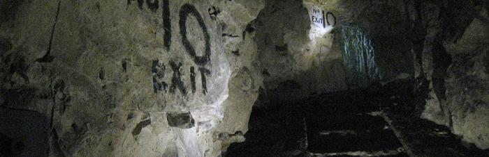
It also bears witness to the developments in military architecture and the transition from bastioned architecture to underground architecture.
 
The aims of the Association de Sauvegarde du Fort De Villiers (Association for the Protection of the Fort De Villiers or ASFV), created in March 2008, are to promote initiatives designed to improve awareness of the fort, in support of the historical and photographic archive documents and the project for its conservation and improvement. 


Fort de Villiers

Avenue Paul Belmondo

93160 Noisy-le-Grand

E-mail : contact@asfv.eu


Visits Warning! Fort de Villiers is not open to visitors. The site is dangerous and is not protected by security (entry is prohibited). 


Contact the Mairie in Noisy-le-Grand to request access.


Bibliographical sources Annals of the National Assembly.  Government bills, proposals and reports. 1874 List of the law bills of the French Republic. 1874


Fort de Villiers


Quizz : Forts et citadelles


> Return to results

Practical information

Address

Avenue Paul Belmondo 93160
Noisy-le-Grand

Weekly opening hours

Le fort n'est pas ouvert au public.

Email : contact@asfv.eu

The Shoah Memorial

The Shoah Memorial. Source: Shoah Memorial


Located in the Marais quarter in Paris, today it has become the reference institution in Europe for the Shoah.


The Shoah Memorial was opened to the public on 27 January 2005 for the sixtieth anniversary of the liberation of the Auschwitz camp and the European Day in Memory of the Holocaust and for the Prevention of Crimes against Humanity.


Located in the historic Marais quarter of Paris, today it has become the reference institution in Europe for the Shoah.

Understanding the past to shed light on the future – that is this site’s mission as a place of remembrance, a museum and a documentation centre.


Open to a wide, diverse public, it provides numerous spaces and activities: a permanent exhibition on the Shoah and the history of the Jews in France during World War II, a temporary exhibition space, an auditorium that schedules projections, conferences, debates, book presentations, etc., the Wall of Names engraved with the manes of the 76,000 Jewish men, women and children deported from France between 1942 and 1944; the Wall of the Righteous which bears the names of the 2,693 Righteous Among the Nations who protected or saved Jews in France during the Nazi occupation; the crypt, a place of contemplation where the ashes of victims of Auschwitz and the Warsaw ghetto are held; the Centre of Contemporary Jewish Documentation (one million documents archived, 90,000 photographs and 50,000 books) and its reading room, a multimedia space, pedagogical areas where workshops are held for children and activities for teacher classes, and a bookstore.


Intended for the widest public, the Shoah Memorial contributes to teaching about a crime that is unique in the history of humanity, but also takes part education and discussions on tolerance, freedom and democracy.


Shoah Memorial

17 rue Geoffroy l'Asnier 75004 Paris

Tel.: +33 (0)1 42 77 44 72 (switchboard and voice mail server)

Fax: +33 (0)1 53 01 17 44

E-Mail: contact@memorialdelashoah.org


Opening hours

The museum is open every day except Saturdays from 10 am to 6 pm and Thursdays to 10 pm.


Closed on Saturdays, certain national bank holidays and certain Jewish holidays.

The reading rooms and the multimedia education centre are open every day except Saturdays from 10 am to 5.30 pm and Thursdays to 7.30 pm.

Mémorial de la Shoah


> Return to results

Practical information

Address

17 rue Geoffroy l'Asnier 75004
Paris
01 42 77 44 72

Prices

Temporary exhibition: Free admission Auditorium: Full price: €5 / Reduced price: €3 Children’s workshops: €6

Weekly opening hours

Open daily, except Saturdays, from 10 am to 6 pm and Thursdays to 10 pm

Fermetures annuelles

Closed on Saturdays, certain national bank holidays and certain Jewish holidays

The fortifications of Saint-Martin-de-Ré

Vue aérienne de Saint-Martin-de-Ré. Source : GNU Free Documentation License

In 1681 Vauban strengthened the island's defences by constructing a citadel and a fortified castle.

The l'île de Ré, opposite La Rochelle, was subjected on several occasions to attack from British soldiers. Conscious of the need to protect access to La Rochelle and Rochefort, in 1681 Vauban started strengthening the island's defences by building a citadel and fortified castle at Saint-Martin-de-Ré, on the North coast.

Built on the site of a fortress where construction work had started in 1627, the square-shaped citadel occupies the eastern part of the town. Its defensive system comprises four bastions, three demi-lunes and a counterguard, surrounded by a moat and a covered walkway. It contained an arsenal, food and powder stores, barracks and officers' accommodation. The citadel opens on to the sea via a small fortified port. From 1873 onwards it became a stop-off point for penal colony prisoners on the way to New Caledonia until 1897 and later to Guyana until 1938. Today it remains a prison for more than 400 detainees and is not open to the public.
An example of Vauban's first system adapted to suit a flat site, the construction was accompanied by an enormous fortified enclosure capable of accommodating the island's population of some 16,000 inhabitants, as well as their livestock, and of storing food supplies and forage in the event of enemy attack. In an arc on the land side, there are bastions, orilloned half- bastions and a counterguard. Two monumental gates, the Porte Toiras and the Porte des Campani form the access points. Also surrounded by a moat and a covered walkway, it is in addition encircled by an open-plan glacis, sloping outwards from the ramparts within canon-firing range.
Saint-Martin de Ré Tourist Information Office 2, quai Nicolas Baudin Ilot du Port - BP 41 17410 Saint-Martin-Ré Tel.: + 33 (0) 5 46 09 20 06 Open from 01-07 to 31-08, from 10 am to 7 pm, Monday to Saturday and from 10 am to 1 pm and from 3 pm to 5 pm on Sundays and Bank Holidays from 01.06 to 30.09: Monday to Saturday from 10 am to 1 pm and from 2 pm to 6 pm and from 10 am to 1 pm on Sundays and Bank Holidays In May: Monday to Saturday from 10 am to 1 pm and from 2 pm to 6 pm and from 10 am to 12 pm on Sundays and/or Bank Holidays In April and during school holidays: Monday to Saturday from 10 am to 12 pm and from 2 pm to 6 pm and on Sundays and Bank Holidays from 10 am to 12 pm from 01-10 to 31-03: Monday to Saturday from 10 am to 12 pm and from 2 pm to 6 pm

> Return to results

Practical information

Address

Cours Vauban 17410
Saint-Martin-Ré

Prices

Visite guidée Plein tarif: 6 € Tarif réduit: 2,50 € Groupes (+ de 20 personnes): 5,5 €

Weekly opening hours

Accès libre toute l’année. Visite guidé sur réservation le mardi et jeudi à 10h30 pendant les vacances scolaires.

Camaret-sur-Mer Vauban tower

Le Sillon - vue prise de la pointe du Grand Gouin, Camaret-sur-Mer. Source : ©Michael Rapp - License Creative Commons - Libre de droit

The aim of the Vauban tower was to defend Brest harbour from enemy invasions and pirates.


The tower was built close to Notre Dame de Rocamadour chapel, at the end of the breakwater which protects Camaret port, at the entrance to the Crozon peninsular. It was part of a complex strategy designed to defend Brest harbour from enemy invasions and pirates.


The tower was built between 1693 and 1696 under the supervision of the engineer Jean-Pierre Traverse. It has four floors (basement, ground floor and two upper floors) and is 18m high to the roof.

The basement, with trap door access, was used to store food and powder.

A spiral staircase leads to the upper floors which housed the guard room and accommodation.

The hexagonal tower features arrow slits for defensive purposes. Acute angles of attack mean that projectiles could be deflected. It is also known as the Tour Dorée (Golden Tower) because the base is finished with a coating made from crushed bricks.


The tower is flanked by a low, semi-circular battery with wide embrasures for eleven canons and a defensive guard room. A second guardroom was later built on the site of the shot furnace. A beam drawbridge provided access to the site and the footbridge to the tower.


In June 1694 the tower, as yet unfinished, suffered its first attack, from the Anglo-Dutch Augsbourg League, whose aim was to take control of Brest Harbour. The tower was armed with just nine canons and three mortars, but the effectiveness of its defensive system was clear immediately. The 1,500 coalition men who had landed on Trez Rouz beach in front of Camaret were routed in a few short hours, suffering heavy losses.


Tourist office
15, quai Kléber BP 16 29570 Camaret-sur-Mer
Tel.: +33.(0)2.98.27.87.22


Open high season (01-07 to 31-08) from 10am to 12 noon and 2pm to 6pm every day.
Low season (April - September): 2pm to 6pm Tuesday to Sunday


Entrance
Adults: €3
Reduced rate (students, job seekers, people on income support, etc.): €2
Free entry for children under 12 (except groups)

Vauban association

Major Vauban sites network

> Return to results

Practical information

Address

Quai Gustave Toudouze 29570
Camaret-sur-Mer
02 98 27 94 22

Prices

Plein tarif: 3 € Tarif réduit: 2 € Gratuit : Moins de 12 ans

Weekly opening hours

Avril à octobre: 14h-17h Juillet et août : 10h-12h / 14h-18h

Fermetures annuelles

Fermé le lundi d'avril à octobre

Saint-Charles-de-Potyze National Cemetery

French National Necropolis of Saint-Charles-de-Potyze. Source: DR


The French Military Cemetery in Ypres contains nearly 4,200 tombs of soldiers who gave their lives for France.


The French Military Cemetery in Ypres, Belgium, contains the tombs of nearly 4,200 soldiers who gave their lives for France during the fierce fighting around the city during World War One.


The Ypres sector in Belgium, where the front lines formed a semi-circle around the city, was one of the bloodiest battlefields on the Western Front during the Great War, leaving 500,000 dead.

Five battles took place between the heights of Wijtschate and Messines and the French border, via the Valley of the Lys.

The first (17 October – 22 November, 1914), when the Franco-British troops kept the German troops from breaking through to the ports.

The second (22 April – 24 May, 1915), when the Germans used asphyxiating gases, an arm forbidden by the 1899 Hague Declaration, killing nearly 100,000 soldiers between 1915 and 1916.

The third battle, fought by the British (31 July – 10 November, 1917), was the most costly in terms of human lives, ending at Passchendaele.

The last (April – May, 1918), was one of the last German offensives.


Over 140 cemeteries and three large memorials serve as a reminder of these events.

The French National Necropolis of Ypres, located 25 km south-east of Roeselare on the Route de Zonnebeke, took part in this common effort to pay homage to the courage and stubbornness of the French soldiers who died for France. Some of them are buried on nearly three hectares (7.5 acres).

It holds 3,547 individual tombs and an ossuary containing the bones of 609 unidentified soldiers. A Breton Calvary and the tomb of Colonel Chaulet (No. 3478) of the 35th Infantry Brigade are among the landmarks at the site.


French Embassy in Belgium

65 rue Ducale 1000 Brussels

Tel.: 32(0)2.548.87.11

Fax: 32(0)2.513.68.71

e-mail: ambafr@ambafrance-be.org


Direction Interdépartementale de Lille

Cité administrative Rue de Tournai 59045 Lille Cedex

Tel.: 03 20 62 12 39

Fax: 03 20 62 12 30

e-mail: mailto:diracmetz@wanadoo.fr


> Return to results

Practical information

Address

Zonnebeek 8900
Ypres
Tel. : 32(0)2.548.87.11Fax. 32(0)2.513.68.71 Direction interdépartementale de LilleCité administrativeRue de Tournai59045 Lille CedexTel : 03 20 62 12 39Fax : 03 20 62 12 30Courriel : mailto:diracmetz@wanadoo.fr

Weekly opening hours

Year-round accessibility

Franco-German necropolis in Maissin

Views of the Maissin necropolis. Source: DR


This necropolis, located in the province of Luxembourg, covers 5,040 m².


The Maissin necropolis is located in the province of Luxembourg, Belgium, 45 km north-east of Sedan, in the present Paliseul community of communes.

It covers 5,040 m². A Breton Calvary dating from the 16th century, a commemorative stele honouring the dead of the 2nd Army Corps, and a marker dedicated to Pierre Massé make up its furnishings. This memorial site is the last resting place of 4,782 fighters who died in August of 1914. This military cemetery holds the bodies of 282 Frenchmen and 513 Germans, in individual tombs. 3,001 other French soldiers occupy two ossuaries; 643 Frenchmen and 343 Germans occupy a mixed ossuary.


Origins of the cemetery

After the French 2nd Army Corps’ retreat on 24 August 1914, the German Imperial Army buried hundreds of bodies left on the battlefield. It took some ten days to bury all the French and German bodies. More than 500 Belgian civilians were requisitioned from the neighbouring villages to help remove the bodies and to bury them. On the Route de Transinne, at “Courtil”, mass graves were dug for 30 men. More than 2,000 bodies were buried at this site and at “Baulet”, near the Route de Lesse. During the war, the German occupation authorities (the Imperial General Government of Belgium headed by General von Bissing) set up all these cemeteries for the fallen fighters of August 1914.


The inaugural ceremonies took place with senior military dignitaries in attendance. Maissin holds French and German bodies in three large necropolises: cemetery No. l on the Route de Transinne, and cemeteries No. 2 and No. 3 on the Route de Lesse, where the bodies of the soldiers from the surrounding mass graves were reburied in individual tombs. The 16th century Breton Calvary was brought from the town of Trëhou, in the Finistère department, and was placed in cemetery No. 2 to commemorate the sacrifice of the Breton soldiers of the 2nd Corps. It was inaugurated in August 1932 on the 18th anniversary of the battle.

When rehabilitation work was undertaken on this cemetery, remains were exhumed from the abandoned smaller necropolises nearby: 382 German soldiers and 46 French soldiers from the cemeteries of Maissin, Ochamps and Orgéo were reburied here.


French Embassy in Belgium

65 rue Ducale 1000 Brussels

Tel.: 32(0)2.548.87.11

Fax.: 32(0)2.513.68.71

www.ambafrance-be.org

e-mail: ambafr@ambafrance-be.org


Direction Interdépartementale de Lille

Cité administrative Rue de Tournai 59045 Lille Cedex

Tel.: 03 20 62 12 39

Fax: 03 20 62 12 30

e-mail: mailto:diracmetz@wanadoo.fr


> Return to results

Practical information

Address

6850
Paliseul
Tel. : 32(0)2.548.87.11Fax. 32(0)2.513.68.71 Direction interdépartementale de LilleCité administrativeRue de Tournai59045 Lille CedexTel : 03 20 62 12 39Fax : 03 20 62 12 30Courriel : mailto:diracmetz@wanadoo.fr

Prices

Free admission

Weekly opening hours

Year-round accessibility

The Hartmannswillerkopf

Cemetery. ©Evadb

The Hartmannswillerkopf, a rocky mountain spur dominating the Alsace plain to the south of the Vosges, is one of the four national Great War monuments

During the First World War, the Hartmannswillerkopf, a rocky mountain spur dominating the Alsace plain to the south of the Vosges, occupied a strategic position. More than 150,000 men belonging to regiments that came from the whole of France, in particular the Chasseurs et les Diables rouges (Chasseurs and Red Devils) of the Colmar regiment, fought there for four years in order to re-conquer the Alsace. Around 25,000 officers, non-commissioned officers and soldiers fell on the "Vieil Armand", as the poilus or foot soldiers christened it. Situated in the Vosges mountain range at an altitude of 956 metres, the Hartmannswillerkopf site is one of four national monuments of the Great War, during which time it was a strategic battleground. About 25,000 French soldiers died on the slopes of the "Vieil Armand". Listed as a historic monument in 1921, it has been developed thanks to a national fund under the noble patronage of the President of the Republic and five Marshals of France. Several buildings were constructed between 1924 and 1929 at this important place of remembrance and the whole place was inaugurated in October 1932 by the President of the Republic, Albert Lebrun.

Today the site of the battlefield, well maintained and signposted, is one of the most well preserved in France. Forty-five kilometres of paths and trenches provide access to French fortifications, such as the Roche Sermet and the Roche Mégard and to some German structures (Aussichtsfelsen etc.). These paths also lead to a cemetery, to the monument to the 152nd infantry regiment and to the steles (Serret, Chambaud and the one recalling the sacrifice of lieutenant Pierre Scheurer, who died on the 28th April 1915) and finally, to some German monuments such as the one to the chasseurs, and to the staircase with 560 steps "to the sky".
Built on sloping land, the Silberloch cemetery has 1,264 graves of soldiers who could be identified and six ossuaries. Dominating the cemetery, an alter to the Homeland, facing east towards the summit of the Hartmannswillerkopf, has been constructed on a stone esplanade above the crypt. Identical to the one of 1790, it symbolises the mass movement of volunteers who rushed to the borders to defend the Republic. On its four sides are the names of the towns that took part in financing the collection of monuments: Paris, Strasbourg, Colmar, Mulhouse, Besançon, Metz, Lille, Rouen, Lyon, Marseille, Bordeaux, Nantes etc. An eighty metre long trench provides access to the cultural crypt, in the centre of which is the ossuary. Covered with a bronze shield six metres in diameter, it contains the remains of some 12,000 unknown soldiers. The word "Patrie" (Homeland) is engraved on the shield in gold lettering. The entrance to the crypt, which is closed by a wrought iron gate bearing the inscription Ad lucem perpetuat, is guarded by two archangels created by the sculptor Antoine Bourdelle.
Inside, weapons and equipment recovered from the battlefield are on display, as well as photographs and sculptures. On the walls of the corridor leading to the crypt are bronze plaques bearing the numbers of the 101 units, regiments et battalions that succeeded each other on the battle field over fifty-two months. A Catholic Chapel with a statue of the Virgin Mary on top, also by Antoine Bourdelle, is decorated with inscriptions composed by Monseigneur Ruch, the first bishop of Strasbourg after 1918. Sites for the Protestant and Jewish religions have also been built. A reinforced concrete cross 20 m high and 5.25 m wide stretches out towards the hills of the Vosges. It was illuminated for the first time on the night of the 10th November 1936.
The Vieil Armand Battlefield Route des crêtes 68700 Wattwiller Tel.: 03 89 75 50 35

> Return to results

Practical information

Address

68700
Wattwiller
03 89 75 50 35

Weekly opening hours

Accessible toute l'année de 14h00 à 18h00

Fermetures annuelles

du 1er mai à fin octobre uniquement les dimanches et jours fériés

The Internment and Deportation Memorial at Royallieu

Carte postale de Royallieu. Source : http://www.11mai44.info/

The memorial, a historic place, is a reminder of the events that took place at the site of the former Royallieu internment camp.

Last February a memorial was opened on the site of the former Royallieu internment camp. As place of history, it is a reminder of events, setting them within the context of the Second World War and the Nazi policies of repression and extermination. As a place of remembrance, it pays homage to all those who were detained there before being deported to Germany and Poland or shot as hostages. In 1939, the Royallieu barracks near Compiègne in the Oise département was used as a military hospital before being converted by the Germans in June 1940 into a camp where they brought French and British prisoners of war.

In 1941, they turned it into a " permanent concentration camp for active enemy individuals" under the official name of Frontstalag 122, which became a "German police detention camp" by virtue of decree on the 30th December 1941. Resistance fighters, political and unionist militants, Jews, civilians arrested in raids and foreigners etc. - more than 45,000 of them would pass through there before being deported to Nazi concentration and extermination camps. "I got out of the last departure and really hope not to be in on the next one. I am here with some really nice, good people: communists, Gaullists, royalists, priests, aristocrats and country folk - it's an extraordinary mixture", the poet Robert Desnos, who was interned on the 20th March 1944, wrote to his girlfriend. A short respite. A death train took him away on the 27th April to Flöha en Saxe and he was to succumb to typhoid on the 8th June 1945 at Terezin. It was from the camp at Royallieu that the very first deportation train was to leave French soil on the 27th March 1942. It took over a thousand Jews to Auschwitz, as did the next one on the 5th June. A third convoy, consisting mostly of communist and unionist hostages, left Compiègne on the 6th July. Royallieu was thus to become a transit camp for detainees, for the most part political and resistance fighters, prior to their deportation.
A place for remembering Research carried out by the Remembrance of the Deportation Foundation at the History Department of the Ministry of Defence's archive office for victims of contemporary conflicts has allowed the identification of the departure of twenty-six large convoys, in addition to a dozen small convoys between 1942 and 1944. Including the first two convoys of deported Jews, this makes a total of forty convoys. Since the camp also served as a place for detaining hostages, other internees were shot in the surrounding forests once reprisal measures had been agreed. It is to all these people that the internment and deportation memorial is dedicated. This has just been built on part of the former camp by the town of Compiègne in partnership with the Remembrance of the Deportation Foundation, the Defence Department (Directorate of Memory, Heritage and Archives, SGA/DMPA), the Regional Council of Picardy, the General Council of the Oise, the Heritage Foundation and the Caisse des dépôts et consignations (a government body in charge of investing and lending public money). The historian and filmmaker Christian Delage created the journey through history. The architect and scenographer Jean-Jacques Raynaud designed the setting. The result is solemn, due as much to the materials used - glass, concrete and stone - as to the way the floors and walls in the three preserved buildings that remain out of the original twenty-five have been stripped back to their initial condition, and the use of sounds and images to set the scene. Opposite the entrance stands a wall to guide visitors towards the reception hall. Made up of a series of glass pillars bearing the names of all the deportees and internees of the camp at Royallieu identified to date, its purpose is to give the internees back their identities. It is through these names that visitors are introduced to the site. Around the buildings is what is today a garden of remembrance, as well as an exhibition area: plans of the internment camp, group photographs of the guards and written and recorded accounts accompany visitors as they retrace the history of the site.
The memorial provides two routes that are complementary to and inseparable from each other. One of them, the result of the hard work of historians, puts the history of the camp in context; the other encourages visitors to follow their own personal remembrance trail. The history is mapped out along a frieze running the length of the walls of the ten halls that form the tour. It covers in succession: the historic context, internment and the daily life of the camp, transportation on the deportation trains and forced labour and death in the Nazi camps. Documents and archive films illustrate the descriptions. Letters, photographs, drawings and recorded eyewitness accounts tell of life at Royallieu. In places, the images projected onto the walls and floors dominate the whole room. The remembrance trails themselves are an opportunity to meet the many witnesses, who tell of how they survived their passage through this transit camp. These accounts, in several different voices, demonstrate the wide diversity in the backgrounds of the detainees, their opinions and the conditions in which they were held. These men and women are constantly present: their names, their faces, their words and their written accounts remain with the visitor. The buildings are both exhibition halls and "exhibits" at the same time. The walls, floors and ceilings are all in their original condition: the tiles and lino have been removed, to reveal the original rough concrete that internees would have trodden; the false ceilings from the 1970's have been taken down to show the barracks' plastered ceilings; recent paint work has been scraped off to reveal the different layers of materials, colours and decoration beneath.
The words of witnesses The memorial provides many and varied sound recordings. Chosen carefully, some of them contribute in setting the scene. Broadcast all around the place, they are triggered automatically as they detect visitors' movement. Others are transmitted by an audio-guide, available to every visitor. In this way everyone can follow his own audio route, in his own language and at his own speed. The audio-guide can also be used to develop tours for specific groups - young children or the partially sighted - and themed tours etc. The words of the witnesses resonate around the place. They resound off the metal and wooden chairs in the garden and leap out at you as you pass through the corridors of the buildings. It is these different accounts, organised by theme, such as arrival at the camp, daily and social life, ways of surviving, solidarity, loneliness, leaving for Germany etc., that best tell the history of the camp. These sound montages have been created from documents in the huge audio-visual collection built up by the Remembrance of the Deportation Foundation and from new accounts recorded especially for the memorial. At times, the scenography calls on the emotions in a personal way, encouraging visitors to attune their feelings with those of the place itself and to remember rather then to discover. This is why, for example, on the floor in the barracks the positions where the beds would have been are marked using a single line to draw their outlines, extending up the walls to indicate bunk beds. The resulting impression of being cramped together is immediately apparent. In the same spirit, pictures of men and women are projected onto the walls very slowly, one after the other. Letters sent by prisoners to their families have been collected in two virtual albums that are projected onto two table screens, whilst at the same time being read aloud by actors. The tour ends in a room dedicated to the history of deportation, genocide and the punishment of criminals.
The contribution of the Defence Department Through the general administration department's Directorate of Memory, Heritage and Archives, the deputy minister for ex-servicemen awarded a grant of two million Euros spread over 2005 and 2006, as a contribution to the creation of this place of remembrance. In addition, the Defence Department, now the owner of the site of the former barracks at Royallieu, transferred the management of two hectares of land to the town of Compiègne and it is on this land that the Internment and Deportation Memorial was built.
Internment and Deportation Memorial Camp de Royallieu 2 bis, rue des Martyrs de la liberté 60200 Compiègne Tel. 03 44 96 37 00 E-mail: memorial@compiegne.fr

> Return to results

Practical information

Address

2 bis rue des Martyrs de la liberté Camp de Royallieu 60200
Compiègne

Prices

Plein tarif: 3 € Demi tarif: 1,5 € Gratuit : Anciens combattants et victimes de guerre, anciens internés, déportés, enfants (- de 6 ans), les groupes scolaires de l'Agglomération de la Région de Compiègne et les Centres aérés de la ville de Compiègne

Weekly opening hours

Tous les jours de 10h à 18h

Fermetures annuelles

Fermé le mardi

Memorial - Battle of Arras

The Battle of Arras Memorial. Source: Town of Arras


The memorial, which stands in the former Wellington Quarry, commemorates the offensive launched by the British in Arras in April 1917.


The Battle of Arras Memorial was opened to the public on 1 March 2008. Erected in the former Wellington Quarry, it commemorates the Allied Engagement and the role this location played in the planning of the British offensive of April 1917 in Arras.


In spring 1917, the French General Nivelle, while preparing the Chemin des Dames offensive, requested that the commander of the British troops launch a diversion attack in the sector of Arras.

The main difficulty with this operation was gathering the troops in large numbers without attracting the enemy’s attention. The New Zealand fire brigade were commanded to dig tunnels beneath the enemy trenches in order to link together the old quarries used by stonecutters in the 15th and 16th centuries and create a huge underground network stretching 20 kilometres. It allowed the British troops to come out from nowhere, on the morning of 9 April, a few metres from the German front line.

This underground network was the biggest of its kind ever constructed by the British troops. The other purpose of these passages was to meet the basic needs of the 24,000 men billeted there prior to combat, the quarries providing a high level of security despite its close proximity to the Front with kitchens, showers and latrines installed as well as a military hospital. To facilitate their movements around the tunnels, the New Zealand and British troops named the quarries after towns and cities from their homelands. The main quarry was named Wellington.


A recent research programme carried out on these quarries by Arras’ archaeological department unearthed many traces of their former French and British occupants, the soldiers who lived and fought here during the war. In light of the interest these new-found testimonials hold in helping us to understand the everyday lives of the soldiers, a thorough inventory of the passages was made in the Wellington Quarry.


The town of Arras took the initiative to build this memorial, part funded by the Regional Council, the French Ministry of Regional Planning, the Urban Community, the General Council and the Ministry of Defence.

This place of remembrance comprises a remembrance garden and a wall dedicated to the British regiments who fought in this battle engraved with the names of all the soldiers. Documents about Arras dating back to the Great War are displayed in the half-buried reception hall.

Over 75 minutes, the tour pays tribute to the engagement of the Allied troops around Arras, focusing more on the soldiers’ everyday lives than the war itself. The quarry is open to groups of up to 17 people led by a tour guide. A glass lift takes the group 20 metres below ground to visit the 350 metres of tunnels that have been renovated.


This strategic network also housed the living quarters of thousands of soldiers billeted below ground. Drawings and graffiti, bas reliefs, crosses and other features can be seen on the walls, along with traces left behind by the soldiers such as helmets and rusted tins of food.

Each visitor is given an audio-guide that describes 10 sequences illustrated by visual projections and light shows on the surrounding walls: the discovery of the underground world; the traces left by the working quarry in the Middle Ages; the tunnel of history (the quarries up to 1916); the objectives of this unique military strategy in the context of the war; the tunnelling operation in 1916 and 1917; daily life in the quarries in April 1917; the construction of the network, and the Battle of Arras in April 1917. To conclude, a film about the Battle of Arras, based on archives from the Imperial War Museum, is shown in a room at the end of the tour. The memorial hopes to welcome 60,000 visitors a year.


Wellington Quarry

Rue Delétoile 62000 Arras

Tel: +(0)3 21 51 26 95


Office de tourisme d'Arras


Carrière Wellington

> Return to results

Practical information

Address

Rue Delétoile 62000
Arras
03 21 51 26 95

Prices

Price: €6.80 Concessions: €3.10 Standard group price: €5.80 “Advantage” group price: €4.30 Standard school price: €2.90 “Advantage” school price: €2.10

Weekly opening hours

10 am to 12.30 pm and 1.30-6.00 pm

Fermetures annuelles

1 January and the three weeks immediately after the Christmas holidays. 28, 29 and 30 June and 25 December.

Charles de Gaulle Historial

La salle multi-écrans. Source : Historial Charles de Gaulle

Neither a memorial nor a museum, the Historial is an avant-garde place of learning with the emphasis on images, in all their forms, through the use of various interactive devices.

On the 22nd February 2008, the President of the Republic opened the Charles de Gaulle Historial at Les Invalides. This "audiovisual monument" is an avant-garde place of learning based on a strong preconceived museographical idea: using sound and images to retrace the route of a man whose own destiny became entwined with that of France.

Covering about 2,500 m², the Historial is a real "audiovisual structure" whose objective is to convey both the history and the memory of General de Gaulle. Created by the architects Alain Moatti and Henri Rivière, the Historial is housed in a concrete structure, invisible on the surface, beneath the Valeur courtyard of the Hôtel National des Invalides. There are no objects here, only still and moving images. In addition, the Communication and Audiovisual Production Company for the Department of Defence (ECPAD) has provided more than thirty minutes of archive films, allowing the production company special access to the original material so that it could make high definition copies. Conducted by the army museum in close liaison with the Charles de Gaulle Foundation, this production is part of the museum's large-scale modernisation programme.
Visitors are greeted on arrival by a mosaic of eighty portraits of Charles de Gaulle, before making their way into the heart of the monument, which is fixed in the ground by an inverted wooden dome. This self-supporting structure contains an enormous spherical auditorium with seating for 200 people, where five screens show a biographical archive film lasting twenty-five minutes and in eight languages. Directed by Olivier Brunet with a commentary written by Maurice Druon and read by actor Francis Huster, this film is an opportunity to find out more about the figure and his actions, set in a historical context. All around this multimedia auditorium there is a permanent exhibition divided into two areas: the history loop and alcoves. The loop is a place for wandering around, made of curved, fluted glass; visitors pass through an area filled with images and sounds recalling the major events of the 20th Century, from the Belle Époque up to the first man on the moon. The three alcoves are fitted with interactive equipment and are designed to allow those who wish to expand their knowledge of history to learn more about its complexity and consequences. The first is dedicated to the man of the 18th June; the second to him as liberator; the third as the founder of the 5th Republic, from the Constitution of 1958 until the events of May 1968.
In addition, all along the route, the bilingual French/English audio guide provided to visitors is an aid to interpreting the subject matter and the meaning of the images. A temporary 350 m² exhibition hall and a teaching workshop complete the collection. The originality of the Historial is in its use of audiovisual and sound archives to bear witness to a century on which Charles de Gaulle made his mark. The general public can personalise their journey through this innovative complex, where the emphasis is on interactivity. A spectacular journey that is both a scientific and artistic way of following De Gaulle's career.
-

> Return to results

Practical information

Address

rue de Grenelle 75007
Paris

Prices

Plein tarif 8 € Tarif réduit 6 € pour les étudiants de moins de 26 ans, les anciens combattants, les groupes du 3e âge (minimum 15 personnes de plus de 60 ans). Gratuité pour les -18 ans étudiants en histoire et histoire de l'art, militaires, handicapés et leurs accompagnateurs, chômeurs et bénéficiaires du RMI.

Weekly opening hours

Ouvert du mardi au dimanche Du 1er octobre au 31 mars, de 10h a 17h, et du 1er avril au 30 septembre de 10h à 18h.

Fermetures annuelles

Fermé le 1er janvier, 1er mai, 1er novembre et 25 décembre.

Le Grand Bunker - Atlantic Wall Museum

©Le Grand Bunker - Musée du mur de l'Atlantique

The " Atlantic Wall Museum " at Ouistreham, in Calvados, is situated inside the former German Headquarters that commanded the defences of the mouth of the Orne river and the Caen canal.

The preserved structure of this bunker, with its five floors, is unique.

It was to make up for the lack of relief on the Nacre coast that in 1943-1944 the Germans built this tower, which was 17 metres high in order to increase the range of the rangefinder.


From the rangefinder room (the rangefinder measured 4 m in length at the time and had a range of over 30 km), the position of enemy warships was determined.


The information was then transmitted to the floor below (level 3), where the firing calculations were made and then transmitted to the batteries that depended on this fire command post.


It was put out of operation on the morning of the 6th June by a 380 mm shell from the British destroyer H.M.S. "Frobisher".


But it was not until the 9th that it was taken by Lieutenant Bob Orrell, with the capture of 53 prisoners.


Le Grand Bunker - Atlantic Wall Museum

Avenue du 6 juin - 14150 Ouistreham

Tél. : 02 31 97 28 69 - Fax : 02 31 96 66 05

E-mail : museegrandbunker@sfr.fr


Site du musée


Site du comité régional du tourisme de Normandie

> Return to results

Practical information

Address

Avenue du 6 juin 14150
Ouistreham
02 31 97 28 69

Prices

Entrée : 7€ Enfant de 6 à 12 ans : 5€ Le Musée participe à l'opération PASS (réduction sur l'entrée de 1€)

Weekly opening hours

Tous les jours sans interruption De 10 h a 18 h du 1er février au 31 décembre De 9 h a 19 h du 1er avril au 30 septembre

Muséosite d'Oradour-sur-Glane

Salle d'exposition. Source : Centre de la mémoire d'Oradour

This project to build a museum on the site, of the martyr village which began in 1992 under the auspices of the council of the French department of Haute-Vienne, was completed on 12 May 1999, after which it opened its doors to the public and became the new access route to the ruins of Oradour-sur-Glane.

On 8 June 1944, two days after the Normandy landings, the 2nd German armoured tank division, "Das Reich", received orders to position itself between Tulle and Limoges. The "Der Führer" regiment was put in charge of "cleansing" this sector since German troops had been confronted by a series of actions organised by local members of the French Resistance. On 10 June 1944, the market town of Oradour-sur-Glane, which lies 22 kilometres north-west of Limoges, was surrounded by Waffen SS troops. The inhabitants of the village and surrounding areas, who had met in the town for the weekly fair held there each Saturday, were rounded up into the main plaza and systematically slaughtered: women and children were locked inside the church and burned alive, while men were machine-gunned down in various parts of the village. Soldiers went into streets and houses, killing at random so as to eliminate any witnesses, and tried to dispose of the corpses by setting fire to them or throwing them into a mass grave to prevent identification. By the time the troops have finished pillaging and burning the village, they left behind them a death toll of 642, plus a handful of survivors, witnesses to the tragedy.

On 4 March 1945, General De Gaulle, the head of the provisional government of the French Republic, made the journey to Oradour and declared the site a martyr village. It became property of the French government in April 1945. A law declared the site a historical monument on 10 May 1946. A decision was made to protect the ruins and to build a new market town next to the former village. In the late 1980s, the idea was born to build a memorial centre to explain, for educational purposes, the significance of the event and the ruins to generations not familiar with the horrors of war.
Construction of this centre began in 1992 under the auspices of the council of the French department of Haute-Vienne and the work was completed on 12 May 1999, after which the centre opened its doors to the public and became the new access route to the ruins of Oradour-sur-Glane. Inside a building whose architecture is testimony to the tormented history of the site, there is a permanent exhibition containing a number of archival documents that lead the visitor down a pathway, enabling them to situate the tragedy in the context of World War II. Why Oradour? In order to answer this question, the memorial centre sets out to simultaneously present the peaceful market town that was Oradour from the pre-war period until the tragic events of 10 June 1944 and the increase in the barbarity of the Nazis, in particular by the "Das Reich" division of the Waffen SS. An account of the massacre is given in a rolling 12-minute film. The film draws on eyewitness accounts from survivors and statements made by executioners put on trial in Bordeaux in 1953.
Aw well as temporary exhibitions and a documentation centre, the Centre provides an education team to help teachers who wish to organise a visit to the site as part of an educational project. Led by two history professors, the team prepares for the arrival of classes and offers teachers access to the Centre's structures and documentation. Apart from being a symbol of a France wounded by the German occupation, an integral part of the national memory, the Memorial Centre has a universal message, prompting the visitor to reflect on the defence of human rights and peace.
Centre de la Mémoire B.P. 12 87520 Oradour-sur-Glane Tel: 33/ (0) 555 430 430 Fax: 33/ (0) 555 430 431 Website: http://www.oradour.org
Open every day 9 :00 to 17 :00 in February, November and 1-16 December 9 :00 to 18 :00 in March, April, 1-15 May, 15-30 September, October 9 :00 to 19 :00 from 15 May - 15 September Please note: entry to the centre and village closes one hour before stated closing times. Prices Free for children under 8 Non-guided visit: €6 Concession: €4 (students, job-seekers, visitors 8 -18 years of age, war veterans) Family visit (2 adults, 3 children): €16 Youth groups: €2 per person Groups: €4.50 per person for groups of 20 or more (non-guided visits) Guided tours: €6.50 (call 33/ (0)5 55 430 430 for bookings) Coach and car parking facilities, disabled access. Access to the martyr village of Oradour-sur-Glane is free. The village can only be accessed via the memorial centre.

> Return to results

Practical information

Address

l'Auze 87520
Oradour-sur-Glane
0 555 430 430

Prices

Exposition permanente : Tarif individuel : 7.70 € Forfait famille (2 adultes + 2 enfants ou plus) : 22 € Tarif réduit : 5.20 € Exposition temporaire : 2 € Gratuit pour les moins de 10 ans, demandeurs d’emploi, non voyants, handicapés mentaux, journalistes, membres ICOM, chauffeurs de bus

Weekly opening hours

ouvert 7j/ 7 du 1er février au 15 décembre inclus. Du 1er février au 28 février : de 9h à 17h Du 1er mars au 15 mai : de 9h à 18h Du 16 mai au 15 septembre : de 9h à 19h Du 16 septembre au 31 octobre : de 9h à 18h Du 1er novembre au 15 décembre : de 9h à 17h

Fermetures annuelles

Du 16 décembre au 31 janvier inclus

Email : www.oradour.org

Montsec American Monument

Montsec American Monument. © GNU Free Documentation Licence – Royalty-free

Built in 1930, the monument commemorates the attacks carried out by the American Army in 1918 to take the St. Mihiel salient.

Located some twenty kilometres southwest of St. Mihiel Cemetery in Thiaucourt (Meurthe-et-Moselle department) and some fifteen kilometres from the town of St. Mihiel, the Montsec American Monument, built on a 270-metre hill, overlooks Madine Lake.

Produced by sculptor Egerton Swarthout, the monument, built with Euville limestone in 1930, commemorates the attacks carried out by the American Army from 12 to 14 September 1918 and from 9 to 11 November 1918 to take the St. Mihiel salient.


A large walkway leads to an open-air colonnade made up of fluted Doric columns supporting an entablature bearing the names of the towns, alternating with laurel wreaths.


At the centre of the colonnade is a bronze map illustrating the location of the St. Mihiel salient fronts. Damaged during fighting in 1944, the structure was restored four years later. Access to the monument is free.


Montsec American Monument Head toward Saint-Mihiel.

At Loupmont, continue toward Apremont-la-Forêt and then "Massif Fortifié de Liouville".


Montsec Town Hall

8 rue de l'Eglise - 55300 Montsec

Tel.: +33 (0)3 29 90 42 83

> Return to results

Practical information

Address

55300
Montsec
03 29 90 42 83

Weekly opening hours

Free access

Salins-les-Bains Fortifications

Fort Saint André. Source : http://www.salins-les-bains.com


While there are few traces of Marshal Vauban’s interventions at Fort Belin and the Bracon redoubt, Fort Saint André has preserved his indelible mark.


Comtois, rends-toi ! Nenni ma foi ! (Comtois surrender! Never, by my faith!) This motto is the pride of the people of Franche-Comté. People here never surrender to the enemy. For a long time, the enemy was the King of France.

Franche-Comté enjoyed a certain degree of freedom as part of the Holy Roman Empire to the east of the Kingdom of France. This was enough to whet the appetite of Louis XI, Henri IV, Louis XIII and, lastly, Louis XIV.


With the help of Sébastien Le Prestre de Vauban, the Sun King was able to bring it into his realm. Franche-Comté became French. The enemy did not disappear, he just changed nationalities. So Vauban got down to work, making the province an impregnable land.


In 1675, Louis XIV entrusted his brilliant military engineer, promoted to the rank of Marshal of France and Commissioner General of Fortifications, with the task of fortifying the principal strategic points in Franche-Comté. After Belfort, Besançon, Joux and Salins-les-Bains, he worked on three structures defending Salins, a Jura town nestled away in a steephead valley (geographical term designating a steep, narrow valley in a limestone plateau in the Jura) and economic heart of Franche-Comté due to the presence of salt mines, the precious “white gold”. While there are few if any remains of his interventions at Fort Belin and the Bracon redoubt, Fort Saint André has preserved his indelible mark.


All the constructions that Vauban had built starting in 1678 at the site of a small fortress from the first half of the 17th century are there:

  • the forward structure whose mission is to defend the entrance to the fort;

  • the monumental gate bearing the Sun King’s motto: “Nec pluribus impar” (not unequal to many);

  • the crenellated bastions with the wall-walk at the top;

  • two 65-metre long barracks where forty fully equipped holiday accommodations are now housed;

  • the powder magazine topped with an elegant ribbed vault and a lava tile roof, which is now a friendly pub;

  • the governor’s house, which is awaiting renovation;

  • the vast chapel topped with a roof lantern, which has long been abandoned;

  • the central courtyard with pleasant squares of lawn;

  • the holiday and conference environment that now fills the site.


From 1682 to the middle of the 19th century, this fortress served as a State prison. The men and women involved in the famous “Affair of the Poisons” that brought down Madame de Montespan were followed by prisoners locked up by the different regimes by “lettres de cachet” at the request of their families or for political, military or common law reasons, whether former nobles, defrocked priests, suspicious citizens, sans-culottes, Swiss or Spaniards.


Salins-les-Bains Fortifications


Office de Tourisme

39110 Salins-les-Bains

Tél. +33 (0)3 84 73 01 34


Fort Saint-André

Village Vauban 39110 Salins-les-Bains

Tél. +330(3) 84 73 16 61


Fort Saint André


> Return to results

Practical information

Address

39110
Salins-les-Bains
03 84 73 16 61

Weekly opening hours

Du 1er avril au 31 octobre